
Mt Rainier National Park Guide
MPG V2.8, January 2013
Introduction
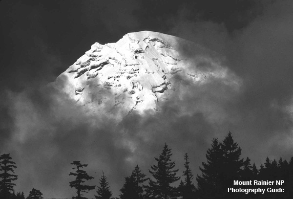
The goal of this series of Web pages is to provide a photography guide and photography tips to Mt. Rainier National Park, in addition to links to on-line and published resources about Mt. Rainier and the National Park. This guide is not intended to be complete as it is an on-going adventure for me and the Web site, so it will be updated as I learn more and find new information. My goal is to provide some information to help your photography of Mt. Rainier and the National Park.
Being the geographer I am, the first thing I'll mention is that you need a sense of place about Mt. Rainier and the National Park. To begin with, let's see where it's at with a regional map (72 Kbytes PDF), and with a larger Park map (2 Mbytes PDF). Additional maps are also available from the NPS and Mt. Rainier NP map Web pages, along with additional information on the Mt. Rainier Web page.
Information
Before you go to Mt. Rainier NP, it's best to sit down with some maps of Mt. Rainier NP, and some travel and visitors guide books. The Park is large as it's a 1-2 hour drive to any of the entrance from Seattle, see travel overview, with additional driving to visitor centers or trailheads.
During the tourist season, Memorial Day to Labor Day holidays, the NP is busy with many parking and trailheads full early in the day, and there are restrictions and fines for parking outside designated areas. The NP operates a shuttle service from mid-June through the Labor Day weekend from Ashford to Longmire and to Paradise.
Photography Guide
Once you are basically familar with the National Park, then you can begin to plan the places for your visit and photography work. To help with this, I have divided the National Park into five areas, which are the White River-Sunrise Entrance in the northeast quadrant, the Cowlitz River-Packwood entrance in the southeast, the Nisqually River Entrance in the southwest, and the Carbon River-Mowich Lake Entrance in the northwest, adding the Paradise area as a separate place.
Each of these areas are accessible by different highways, with only two connecting highways, one north-south in the eastern quadrants and one east-west in the southern quadrants. This means you can do an all day car trip through three of the quadrants, stopping at the visitors center at Paradis, all of which are described on the road trips Web page with map locations for stops, places, etc. If you plan to do any short hikes in the NP you can check the dayhike Web page. If you plan longer day hikes, you should be prepared with a day pack and the outdoor essentials.
Mt. Rainier Photography Books
Before you plan your photo locations in Mt. Rainier NP, there are a number of excellent photography books along with photographers' Web sites in photography guide Web page on Mt. Rainier NP to get ideas of places and photographs. Most good bookstores should have these.
- "Washington's Mount Rainier National Park", Pat O'Hara and Tim McNulty
- "Mount Rainier National Park, Realm of the Sleeping Giant", O'Hara and McNulty
- "Mount Rainier", Don Geyer
- "Mount Rainier National Park Impressions", Charles Gurche
- "Mount Rainier, Views and Adventures", James Martin and John Harlin III
Please use the contact link to send e-mail.